Hillside District
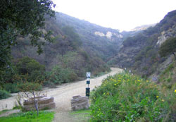 Tucked away in the hills north of Downtown Burbank lies an area where history, recreation and living go hand in hand. The “Hillside District” is comprised of everything north of Glenoaks Boulevard in Burbank. It is home to four schools – Thomas Jefferson, Ralph Waldo Emerson and Joaquin Miller Elementary Schools plus John Muir Junior High School; the Stough Canyon Nature Center; The Castaway restaurant/banquet facilities; the DeBell public golf course and 9-hole par 3 course; the Starlight Bowl amphitheatre; the Verdugo Mountains with their many hiking trails along with a wide array of housing styles and residents who enjoy the views and serene landscapes.
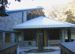
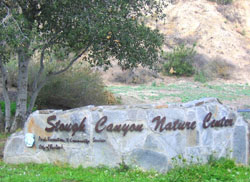 In 1964, Burbank endured one of its worst environmental disasters as floods and fires ravaged the Hillside District, resulting in extensive damage. More than 1,000 acres of the Wildwood Canyon area, close to Stough Canyon Nature Center, burned in the fall of 2005. Stough, which opened in 2001, entertains about 6,000 visitors a year. The nature/science center features information on plants and animals in the mountains as well as a mini-museum of taxidermy animals, such as deer, bobcats and mountain lions. Live animals on display include gopher snakes and king snakes.
  Stough is nestled in the Verdugo Mountains, named for the Verdugo family, which owned the land before California became a state. Guided hiking trails range from one to three miles, and self hikes can go as long as 12 miles, with each vividly reminding the hiker that nature in all its splendor exists less than 10 miles from Burbank City Hall. A popular and quaint residential enclave is “Country Club Drive,” which provides owners with a feeling of “living in nature” while only minutes from the city. The narrow street is known for its peaceful sense of quiet, eclectic architecture and assorted lot sizes, with many homes built against the hillside with easy access to hiking trails.
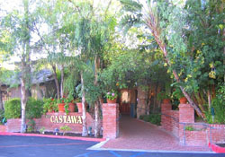 Built high above downtown Burbank, The Castaway Restaurant is one of the “jewels” of Burbank. The restaurant and banquet facility hosts between 600 and 700 weddings a year and over 1,000 dinners a week. The dining and festive occasions are enhanced by the incredible hilltop and city light views. Patrons driving to the Castaway, are treated to a scenic drive through DeBell Municipal Golf Course, which was dedicated and opened for play in 1959. From its picturesque holes set right up against the mountains, to its challenging barrancas and reasonable golf rates
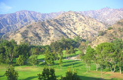 , DeBell is known as not only scenic and challenging, but affordable as well. Golfing enthusiasts can also try their hand at the less daunting 9-hole par 3 course, hit balls at a driving range and enjoy a bite to eat at the facility’s restaurant. Golfers, as well as the entire Burbank community can now enjoy some improvements at DeBell, with improved parking, better driving range lighting along with a beautiful “Craftsman” style clubhouse featuring the popular Canyon Grille restaurant and bar.
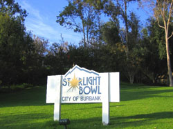 Up the road from DeBell, is the Starlight Bowl, built in 1951. The bowl is home to seven yearly concerts, including the very popular annual Fourth of July celebration highlighted by a dazzling fireworks display. The Starlight Bowl attracts about 20,000 visitors each year, who enjoy a wide array of “family friendly” entertainment at very reasonable prices.
The majority of the Burbank residential housing stock, including the Hillside area, was built during the 1940′ and 1950’s. 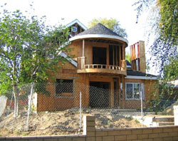 While the architecture was varied, the floorplans were on the small side (commonly 1,000 to 1,500 sq. ft.) as evidenced by the “Ben Mar” development which was built during the 50’s. Many of these homes have or are being enlarged, with some being completely razed, to make room for 3,000+ sq. ft. custom built homes to accommodate the tastes of many of today’s homebuyers. If you’re looking for newer, “executive” housing stock in the “hills,” the gated Halston and Highridge Estates developments offer homes ranging from 3,000 to 6,000 sq. ft, with prices ranging from $1.5 to $3 million. Many of these homes offer spectacular views of the San Fernando Valley and downtown Los Angeles.
The “Rancho” District
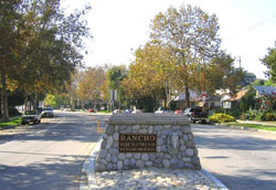 Of all the areas in Burbank, perhaps none has carved out a more unique and identifiable character than the “Rancho” District – known simply as the Rancho to area residents. It’s somewhat of an anomaly: a quaint, equestrian neighborhood bordering the behemoth Walt Disney Corp. entertainment empire and settled just to the north of a major freeway that connects the sprawling San Fernando and San Gabriel valleys. Seeing a horse trot casually on the shoulder of Riverside Drive is hardly atypical. And until only recently, ordinances governing horseshoeing and silversmiths in the district were still on the books.
In 2006-07, the Rancho was catapulted into the national spotlight when a determined contingent of residents battled plans for a proposed Whole Foods Market on the corner of Main Street and Alameda Avenue. News outlets cast the story as a classic David and Goliath scenario: a tight-knit, “equestrian friendly” neighborhood rallying its residents against the “inevitable” traffic congestion and safety hazards that opponents said a 60,000 sq. ft. grocery store would bring to the neighborhood. Though the project developer worked to appease residents’ concerns – twice scaling back the project’s size and scope – the Burbank City Council ultimately sided with their Rancho constituents by narrowly voting to deny the project.
Much like a small rural town, the Rancho is full of people who have lived there most of their lives and don’t plan to leave. Due to zoning laws that allow people to keep horse(s) on their property, along with pleasant tree-lined streets made up of well-manicured homes featuring various architectural styles, Rancho real estate prices are generally comparable to property located above Glenoaks Blvd., with inventory levels always in relative short supply. In fact, despite some of the horse-related negative aspects – flys, dust, “bucolic odors” – 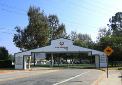 some non-equestrian owners and would-be owners nonetheless seek to live in the Rancho just for the unique feel and close-knit community atmosphere that pervades the area. But for the real horse enthusiast, the size of the “barn,” (size & number of horse stalls); turnout(s); horse keeping amenities; lot size along with proximity and accessibility to riding trails in and around nearby Griffith Park – these are the important factors in buying and living in the Burbank Rancho. Of course, the fact that the Los Angeles Equestrian Center is located just up Riverside Drive doesn’t hurt either.
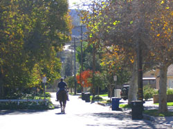 A more detailed look at the Rancho reveals the term really delineates three neighborhoods – all with the common thread of zoning allowing owners to keep horses on their property. All three neighborhoods are in proximity to Riverside Drive, with the “main” Rancho neighborhood running south of Alameda Avenue all the way to Valleyheart Drive, and from Mariposa Street on the east, to the western border portion of the Walt Disney property at Keystone Street. The “second” part of the Rancho then resumes south of Riverside Dr. to Valleyheart and includes the streets Gaylord, Niagara and Fairview. The third part of the Rancho is closer to Burbank’s border with Glendale and consists of the streets Valencia Avenue, Spazier Avenue, Elm Avenue, Lutge Avenue, Linden Avenue & Chavez Street – all south of Alameda Avenue (with the exception of Valencia) and sandwiched between Main Street and Victory Blvd.
Magnolia Park & The Chandler Bikeway
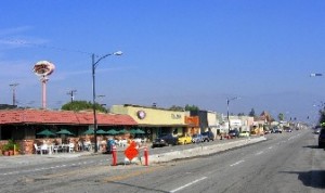
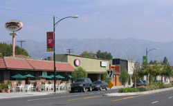
In an age of big-box stores and chain restaurants, Magnolia Park offers shoppers and diners the fast-disappearing commodity of “Mom & Pop” stores with a variety of products and services ranging from the mundane to the very eclectic. From antiques, furniture and vintage clothing to pastries and flowers, the quaint, tree-lined boulevard has a small-town appeal that attracts people to the area. Bordered by West Verdugo Avenue to the south and Chandler Boulevard to the north, Magnolia Park is home to new and longtime businesses alike, with many antique and vintage clothing shops dotting the street. Businesses come and go, but the area has maintained its charm with independently owned shops such as, White Elephant, Hubba Bubba, 8-Ball , It’s a Wrap, which sells vintage clothing and accessories, much of which was used in television and film productions.
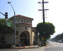 For those seeking to satisfy their hunger pangs, Magnolia Park offers a wide variety of choice. Some favorites include, a Burbank institution, Monte Carlo Deli and Pinocchio Restaurant, where you’re guaranteed to get a lot of good, authentic Italian food for not a lot of money. The same could be said for The New Deal Urban Eats and Tequilas Bar & Grill.
Newer shops and eateries have also contributed to the development of Magnolia Park. The wildly popular Porto’s Bakery generates the most daily foot traffic on Hollywood Way and Magnolia, arguably the “hub” or central point of Magnolia Park. 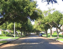 The tremendously successful bakery which also has a location in Glendale, allows patrons to eat in or take out and features a wide variety of Cuban baked goods, soups and specialty items. But the increase in foot traffic to eateries such as Porto’s has also caused parking shortages. And according to both city officials and merchants alike, parking is the No. 1 challenge to insuring Magnolia Park’s continued success. As a means of relieving the parking crunch, the Magnolia Park Business Improvement District made an agreement with Burbank Community Church to share its parking lot when there are no church services being held. The lot, which is behind the church between the streets California and Ontario, was also improved with new surface and landscaping upgrades, all paid for by the city of Burbank. Along with parking, the business improvement district plans to continue in its efforts to beautify the area by adding flower baskets hanging from lampposts, signage and more landscaping – all contributing towards its long term goal of establishing a “visual identity” for Magnolia Park.
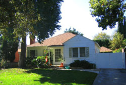 Magnolia Park is one of the more sought after neighborhoods for residential housing in the “flats” of Burbank. Some people use the term “Magnolia Park” loosely, with some associating it with the commercial shopping area in proximity to Hollywood Way. But when talking homes, the designation generally refers to streets that run south of Magnolia Boulevard to Verdugo Avenue, and from Clybourn to the west, to Mariposa (or Glenwood Place) to the east. Like the Hillside area, much of the housing stock in Magnolia Park was built in the ’40’s and ’50’s, with original homes ranging in size from 900 up to 1,500 sq. ft. on 50×135 or 6,750 sq. ft. lots.
 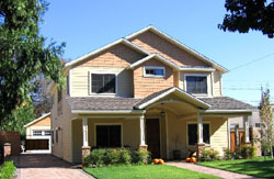 Many of those original homes have been expanded to over 2,000 sq. ft., with the growth trend continuing during the “real estate boom” years of 2001 through 2006 that saw homeowners and custom home contractors building homes over 3,000 sq. ft. But like many neighborhoods in Southern California, some of this “McMansion” construction has resulted in adjacent neighbors feeling their property rights were being infringed upon, with massive neighboring structures now towering over their “original” little Burbank bungalows. In an effort to strike a balance between homeowners who want to maximize their Burbank real estate, versus those who do not have the financial means and/or are content to remain “small,” the city of Burbank invoked a “Mansionization” ordinance in 2005. The ordinance places limits on the height of new construction and additions, as well as prescribing new setback and lot coverage requirements. For more details, go to: www.burbankca.org/planning
Chandler Bikeway
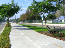 Since its 2004 opening, the Chandler Blvd. Bikeway has provided Burbank residents with an area to go running, ride bikes, walk their dogs and just enjoy the outdoors. The two-mile paved median, which runs down Chandler Boulevard between Mariposa Street and Clybourn Avenue, is lined with grass, blooming landscaping and has two small bronze sculpture gardens, part of the city’s “Art in Public Places” program. In the evenings, especially during Burbank’s hot summer months, the strip draws many residents looking for exercise, as well as social interaction. It’s a far cry from the weed filled, out of service stretch of railroad tracks it used to be. And it certainly hasn’t hurt the real estate values of some of Burbank’s smallest parcels. Many lots on both sides of Chandler are characterized as “half lots” (alluding to the 25 ft. wide frontage which is half the size of a common 50 ft. wide Burbank lot). Many of these properties have seen significant appreciation due to having a “front row seat” on all the new improvements and activity on the Chandler Bikeway.
In 1991, when the abandoned rail line went up for sale, the City of Burbank and the Los Angeles County Metropolitan Transportation Authority (MTA) coordinated its purchase, affecting a joint ownership between the two entities. 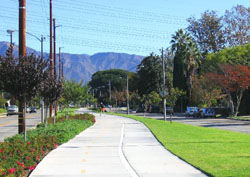 There was some dissension in regards to the vision for the median, but the two negotiated a compromise. The bike path allowed the city to fulfill its goal of beautifying the area with a recreational facility, while satisfying the transportation authority’s requirement of maintaining the median as an active avenue of transportation. In addition to its recreational benefits, the bikeway also has the potential to be a viable route for commuters. Going southwest, the path extends to Vineland Avenue, where the route continues along Chandler Boulevard as a bike lane. At Ethel Street in North Hollywood, the path resumes and runs all the way to Warner Center. Ultimately, Burbank would like to enhance the “commuter potential” of the path by extending it from its current end point at Mariposa, to the Burbank Metrolink Station several blocks away on Front Street in Dowtown Burbank.
Northwest District
As the name implies, this area of Burbank encompasses the northern section(s) of the “flats,” extending from Burbank Boulevard, north to Vanowen Street & Pacific Avenue, and Mariposa Street to the east and running to Clybourn Avenue and Dymond Street at the North Hollywood/Burbank border. The aerospace industry was instrumental in the development of the area and was a main economic driver for many years. Remnants of the old days are still around, and you can find them along a Burbank Boulevard populated by a mishmash of small storefront businesses from beauty care to automotive repair to graveyard markers and a wine seller, among others. The businesses along Burbank Boulevard are eclectic, and many are long-established that have a history that dates back to the days when aerospace was the main industry and people were closely linked to the Lockheed Corporation and related aerospace businesses. Even though aerospace has been replaced by the media industry in the city, it’s still a friendly area, where children play at Ralph Foy and Vickroy parks and where parents meet and children learn at places like Luther Burbank Middle School.
But there are clear signs of change taking place in the area. 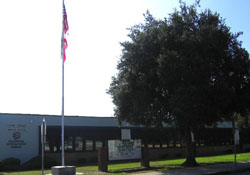 On any given day, traffic surrounds the massive Costco Wholesale warehouse at Victory and Burbank, what used to be known as “five points.” Also, construction crews have been busy doing major improvements to the currently “stark” Burbank Boulevard as part of a beautification effort funded by a Burbank Boulevard merchant’s group and the city. The 2.2 mile stretch of the thoroughfare between Clybourn Avenue and Victory Blvd. is being made more pedestrian friendly and aesthetically pleasing to the eye with the addition of 11 landscaped medians, planting more than 400 trees and the erection of seven new traffic signals designed to improve traffic flow. Another major “art project” for the area was the installation of an elevated landscaped area surrounding a statue of Dr. David Burbank at the intersection of Burbank and Victory boulevards.
Homes in the Northwest District, for the most part, rose from an aviation industry built around Lockheed, which in the late 1930’s established itself as a hub for military aircraft development and later, commercial aviation. 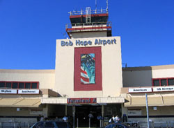 Today the “Lockheed Air Terminal,” is now known as Hollywood Burbank Airport, a “commuter” facility known for its central location and convenient accessibility relative to greater Los Angeles and the San Fernando Valley. But as most Burbank residents will acknowledge, for all of its flying convenience and economic benefits, Hollywood Burbank Airport’s flight activity does impact housing in a portion of the Northwest District. Specifically, homes in the “flight path” – those situated approximately from Pacific Avenue to the north, running to Hatteras Street, and between the Burbank/North Hollywood border and Hollywood Way. Homes in this area are in what is called “65 CNEL impact area” (where aircraft noise exceeds an average of 65 decibels). Although there is a voluntary night time curfew, from 10 p.m. to 7 a.m., Hollywood Burbank Airport offers homeowners in the “impact area” a Residential Acoustical Treatment Program, which they may voluntarily participate in. The program is free to eligible homeowners and consists of new door and window replacement, attic insulation and new central air conditioning & heating (if not already present). In return for the improvements, the homeowner must execute an “avigation easement” disallowing the homeowner from suing the airport over noise related issues.
 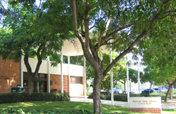 At the end of 2014, approximately 1,200 homes have been or are in the process of being “soundproofed” through the program, out of 1,900 eligible Burbank properties (some homes in North Hollywood and Sun Valley are eligible for the program as well). Also, both Luther Burbank Middle School and the Burbank Adult Education facility have been acoustically treated for airport noise impacts. For more information on the program, go to: www.hollywoodburbankairport.com and click on “Aircraft Noise Issues.”
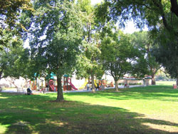 In addition to airport funded improvements, many Northwest Burbank homeowners, both inside and out of the “flight path,” are putting their own money into their residential properties. Generally regarded as the most affordable area to purchase a single family home (in part due to airport noise), many Burbank residents make their first purchase there, often times a 1940’s two bedroom, 1 bath with a single attached garage, make improvement/additions and watch as Burbank real estate appreciation allows them to eventually “trade up” and move further south in the “flats” or up to the “hill.”
Burbank “Neighborhood Name Calling”
What’s in a name? Well, when it comes to the names associated with a city’s neighborhoods, designations and perceptions associated with specific areas can mean a lot, especially when considering the value of property. In Burbank, in addition to the general geographic designations of, “on the hill” or “in the flats,” there are several names for specific neighborhoods or areas in Burbank. With the exception of the “Rancho,” these neighborhoods are “unofficial,” with no signage delineating their boundaries. Some may be familiar, while others are relatively new. But in most cases, these neighborhood names are often associated with certain main streets, industries or adjacent areas that have a favorable connotation(s), thereby serving as a positive influence on property values.
As a lifelong resident of Burbank and a Realtor® with 36 years of experience representing buyers and sellers in Burbank, one of my pet peeves is when, largely out-of-area brokers, but some locals, as well, don’t have a clue about Burbank neighborhoods and totally mischaracterize a house’s location relative to its actual neighborhood. Or sometimes it’s an intentional “stretch,” again, in an effort to try to gain a favorable value perception. That being said, here are, at least in this Burbank Realtor’s opinion, the names and generally accepted boundaries for some of Burbank’s neighborhoods. First, neighborhoods in the “flats” of Burbank:
“Chandler Park”
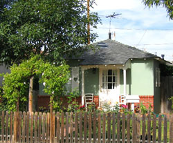 With regard to the “flats” of Burbank, I’ve already talked about “Magnolia Park” and the “Rancho” areas. A relatively newer and lesser known neighborhood is the “Chandler Park” area. As the name implies, this area is comprised of homes along the hugely successful Chandler Bikeway, and south to Magnolia, along with homes north of Chandler up to Burbank Boulevard. The western border is Clybourn Avenue and Mariposa Street to the east. “Magnolia Park North” is another name I’ve heard used for this area as well. As mentioned previously, many of the homes along Chandler Boulevard itself, are built on what can be described as “half lots” – 25 ft. wide and as shallow as 100 ft. deep in some cases. The majority of non-Chandler homes in “Chandler Park” have the more conventional Burbank lot sizes of 6,000 to 6,750 sq. ft.
“Media District”
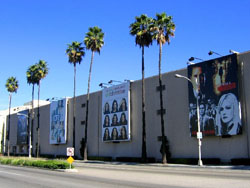 The “Media District” area name was derived, in part, from the “Media District Specific Plan,” along with its proximity to Burbank’s media and entertainment related businesses, both large and small, located in and around Olive Avenue. The “Media District Specific Plan” was formulated in 1991, and was a planning blueprint for the development of the area bounded by Buena Vista Street to the east and stretching to Pass Avenue to the west; with Olive Avenue being the northern boundry and following Olive Avenue down until it becomes Barham Blvd. Some of the larger entertainment companies located in the Media District are: the Burbank Studios (formerly the West Coast headquarters and production studious of NBC and Los Angeles affiliate KNBC/NBC4, which relocated to Universal City in 2014); Warner Brothers Studios that fronts Olive Avenue; along with the smaller Warner Ranch lot bounded by Pass Avenue, Hollywood Way, Oak Street and Verdugo Avenue. Some of the notable “high rise” buildings that were constructed during the development of the Media District” in the 1990’s are: the “Disney Channel” building; the “Tower” and three buildings erected by developer M. David Paul, including the two “Pinnacle” buildings.
Since media/entertainment and other commercial development often abuts residential neighborhoods within the Media District, the MDSP contained specific requirements regarding traffic control, zoning, density and height standards to mitigate against the “Media District’s” commercial component from negatively impacting the adjacent R-1 neighborhoods. In fact, after the massive, ill-fated “Platt Project” failed to win city approval, a local Burbank developer recently gained approval to build in the Media District what was rejected in the Rancho, namely a Whole Foods supermarket. With traffic mitigation measures included to protect the adjacent residential neighborhoods, the mixed use project called “Talaria at Burbank” will feature the aforementioned Whole Foods market as the anchor tenant, with 241 “luxury” apartments above. Construction is expected to be completed sometime in 2016. Like most other residential areas in Burbank, homes in the “Media District” are mostly 1940’s vintage located on quiet tree-lined streets.
“Toluca Woods”
There is the Burbank side, and then there is the North Hollywood side, which makes up the majority of what is known as “Toluca Woods.” 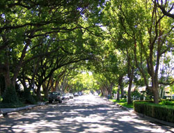 As the name implies, the area tries to borrow some of the affluence and celebrity resident cache associated with its adjacent neighbor, Toluca Lake. The Burbank side of the area really consists of only a few streets, namely: Evergreen Street, Rose Street, Priscilla Lane, Valley Street and Clybourn Avenue – all south of Magnolia (or south of Clark, according to some) and extending to Verdugo Avenue. Other streets often claimed to be part of Burbank’s “Toluca Woods” include: Toluca Park Avenue, Jacaranda Avenue and Woodland Avenue to the south and Ford Street, Kemp Street and the Burbank half/side of Ledge Avenue – all located between Magnolia Boulevard and Clark Avenue.
The North Hollywood side of “Toluca Woods” includes those streets that extend into and are more readily associated with Toluca Lake: Forman Avenue, Sancola Avenue, Arcola Avenue, Placidia Avenue, Ledge Avenue, Biloxi Avenue, Strohm Avenue, Auckland Avenue, along with Addison and Huston Streets.
Burbank/Toluca Lake
Like “Toluca Woods,” Burbank’s adjacent neighborhood to Toluca Lake tries to borrow some of the more affluent attributes associated with its “star studded” neighbor to the west. And while the “Burbank side” is made up of the traditional 1940’s style housing, it also has its share of larger and architecturally distinct estate-type properties indicative of Toluca Lake.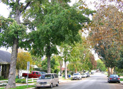 As you might expect, typically, prices are higher because of the neighboring association. However, stars and their estates aside, one of the biggest advantages the “Burbank side” has over Toluca Lake proper, is more moderate pricing (depending on the property) and the municipal services a Burbank address affords a homeowner. Invariably, when promoting a Burbank/Toluca area listing, most brokers highlight the fact that even though the location of the home may be considered to be in the “Toluca Lake area,” a Burbank address provides superior “services” – utility, safety (police and fire) and educational advantages than it’s Toluca Lake neighbor, which is part of North Hollywood/Los Angeles. Of course, given the area’s proximity to the studios and much of the entertainment industry, the Burbank/Toluca Lake neighborhood is especially convenient for those employed in “showbiz,” especially when compared to the congestion and commute challenges associated with the westside of Los Angeles.
Streets located in the “Burbank side of Toluca Lake” are: Evergreen Street, Rose Street, Valley Street and Clybourn Avenue. Also, further south heading towards the entrance to the private Lakeside Golf/Country Club are the streets National Avenue, McFarlane Avenue, Warner Boulevard, Toluca Lake Avenue, Franklin Avenue and Hood Avenue.
“Rancho Adjacent”
 The “Rancho Adjacent” area of Burbank is one of the most desirable sections of the Burbank “flats,” comparable in value and aesthetic appeal to parts of the aforementioned “Magnolia Park,” “Media District” and “Toluca Woods.” As the name implies, the area is located adjacent to the “Rancho,” and is bounded by Alameda Avenue as the southern border, Verdugo Avenue to the north transitioning to Olive Avenue and proceeding to Brighton Street as the western border, with Glenwood Place serving as the eastern boundary. Today, unlike the “Rancho,” the “Rancho Adjacent” neighborhood does not allow homeowners to keep or board horses on their property. However, up until the mid 1950’s, there was a commercial stable on Shelton Street (where the BUSD facilities building is located today) and a scattered number of private residence stables on South Mariposa, S. Griffith Park Drive, S. Beachwood Drive, S. Sparks Street and S. Reese Place. (Note: The “dividing line” that denotes streets as having a “North” or “South” direction preceding the street name is Olive Avenue.)
The California Distinguished School, Delores Huerta Middle School is located in the “Rancho Adjacent” neighborhood at Mariposa and Oak Street. 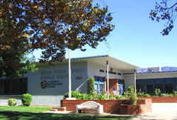 Prior to the construction of the school, part of the current athletic field was once an open pasture that was used for exercising horses. Today the field is used by the school to exercise kids, as well as members of the community who participate in organized soccer games. In response to the growing popularity of these games, the city in concert with the BUSD, is currently in the process of creating a parking lot on the lower athletic field of Jordan to alleviate parking overflow into the residential neighborhood.
More neighborhoods in the Burbank Hillside area:
“Starlight Hills”
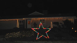 A smaller “enclave neighborhood” is the “Starlight Hills” area of the Burbank Hillside. Consisting of just those homes above Scott Road on Lamer Street, Keystone Street, Trudi Lane and arguably Adornos Way, the Starlight Hills group of homeowners has been meeting socially since 1960 and counts five past city officials as well as very “active” current members of the community among its members. Perhaps best known for placing illuminated “Holiday Stars” in their front yards during the Holiday season, the group meets monthly to plan social gatherings and outings as well as to keep updated on what’s happening in their neighborhood and in the city in general. The group is not a formal homeowners association, but rather epitomizes the best what the term “neighborhood” is all about in Burbank.
Burbank North Estates, Burbank Hills Estates
and Hallston & Highridge Estates
These three neighborhoods in the Verdugo Mountains/hillside section of Burbank represent what could be described as the progressive “up the hill” development of the “high end” sector in the Burbank housing market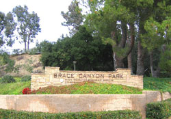 . First, the “Burbank North Estates” was a tract of homes built in the 1970’s with streets and cul-de-sacs located above and in close proximity to one of Burbank’s most picturesque parks, Brace Canyon Park. The homes were considered “lavish” for their day, with many featuring 70’s “neau veau” Spanish architecture with tile roofs, 3-4 bedrooms (including a master suite), family rooms in 2,000+ sq. ft. (considered huge, back then), many with pools/spas and oriented to take advantage of canyon and city lights views.
 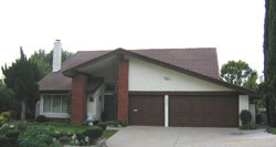 Streets that are part of “Burbank North Estates” include: Crest Ridge Drive, Mesa Verde Drive, Highland View Drive, Adornos Way, Whitney Lane, Brace Canyon Road, Rolling Ridge Drive, Joaquin Drive, Antigua Drive and Amigos Drive. Prices in the “Burbank North Estates” are generally the most modestly priced, compared to Burbank Hills Estates and Hallston & Highridge, with an original square footage home going in the high $700,000 range, on up to $900,000 (depending on updates, size and view). However, some homes which have been expanded and substantially updated can go over $1 million.
The “Burbank Hills Estates” represents the progressive “march up the hill” and the continuation of setting new standards for luxury living in the Burbank hills. 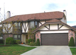 Built in the 1980’s, the “Burbank Hills Estates” is comprised of approximately 130 home sites and reflects a change in size, style(s) and amenities offered, compared to its ’70s predecessor, “Burbank North Estates.” Homes in “Burbank Hills Estates” were generally much larger, ranging in size from 3,000 sq. ft. on up to 5,000+ sq. ft. for the larger home sites. The amenities increased in size and quality from the 70’s as well, with the number and size of rooms increasing, along with more ’80’s fashionable finish materials being offered. Also, the homes were more custom in nature, with a much wider variety of architectural styles and floorplans offered. In addition, lot sizes are much larger, ranging from 8,500 sq. ft. on the smaller side, on up to more than half an acre, with many featuring spectacular views. When first offered, prices in the “Burbank Hills Estates” started in the mid $600,000 range. Today they go for anywhere between $1.1 million on up to $1.7 million.
Some of the streets in the “Burbank Hills Estates” include Haven Way and Viewcrest Drive, along with several others named after former Burbank City officials, such as Howard Way and Court, Remy Place, Olney Place and Reynolds Drive.
Following the real estate downturn during the 1990’s, the “Hallston” & “Highridge” developments represent a resumption of setting new standards in luxury/executive housing offered “further up” in the Burbank hills. 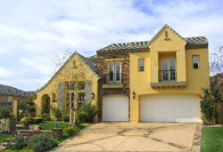 Built in 2000 by the national home builder, Lennar, “Hallston” & “Highridge” is the only gated housing community in Burbank and consists of approximately 120 luxury homes/estates. Floor plans average 4,200+ sq. ft. and over 5,000 sq. ft. for some homes in the “Highridge” section, with lot sizes ranging from 8,500 sq. ft. to over 17,000+ sq. ft., some with incredible views. The development(s) continue the trend of offering the latest in luxury home amenities, such as dramatic entryways; self-contained pre-wired “media rooms;” huge gourmet kitchens featuring center islands, custom cabinetry, granite and various flooring materials; multiple fireplaces; sumptuous master bedroom suites; custom landscapes with various pool/spa configurations and custom outdoor entertainment/barbeque areas, just to name a few.
 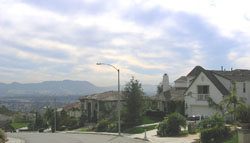 There is a $468 monthly HOA fee which goes towards original community infrastructure, security services and entitles homeowners to use of a community park with barbeque area and tennis courts. Streets making up “Hallston” & “Highridge” include: Clifden Lane, Castleman Lane, Wedgewood Lane, Lismore Lane, Kildare Court, Logan Court, Folkstone Court, Durham Court and Brookshire Court. When first opened for sale, homes started at approximately $1 million. Today, prices start at approximately $1.4+ million, and have gone as high as 2.6 million.

